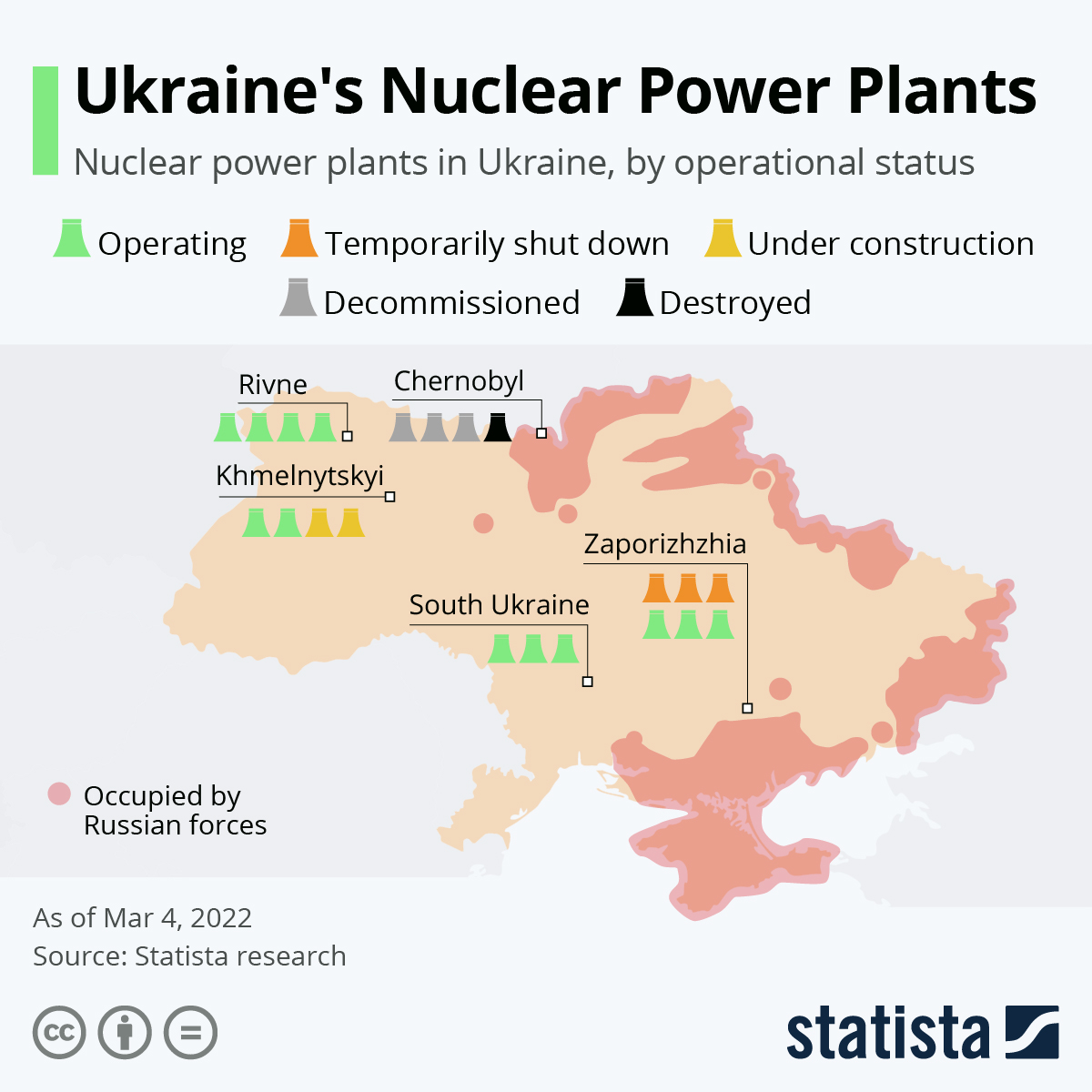
Map of the nuclear power plants in Ukraine. The sign in the form of a cooling tower means one power unit, respectively - a reactor. In green are given the operating reactors, in orange - temporarily suspended, in yellow - the reactors under construction, in gray - decommissioned, in black - destroyed. The territory colored in dark brown is under Russian control, and that in light brown remains in Ukrainian hands.
A fire broke out on the site of a Ukrainian nuclear power plant after a Russian attack last night. According to information from the head of the International Atomic Energy Agency (IAEA), Rafael Mariano Grossi, a training centre of the Zaporizhzhia nuclear power plant, located in the immediate vicinity of the reactors, was hit by a projectile.
As this infographic shows, the nuclear power plant is located in South-Eastern Ukraine. The region is contested, but as of March 3, not yet occupied by Russia. The IAEA also said that according to the Ukrainian government, no increased radioactivity had been measured in the vicinity of the plant, and that staff had taken "measures to minimize the risk".
There had already been fighting last week near the site of the Chernobyl nuclear reactor, where the worst nuclear accident in history occurred in 1986. The nuclear ruin is now controlled by Russian troops. The Rivne, Khmelnytskyi and South Ukraine nuclear power plants, on the other hand, are not yet under Russian command.
Should Putin continue to pursue his goal of bringing all of Ukraine under his control, these nuclear power plants will also be threatened by combat operations.
Source: https://bnr.bg/horizont/post/101610346/otec-nikanor?fbclid=IwAR1U5i-L75…